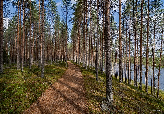
Arpainen info
The Arpainen outdoor and hiking trail consists of more than 50 kilometres of trails in total, ranging from the Ähtäri Zoo all the way to the centre of Soini municipality. The trail network includes three shorter routes: the 3.5 km Kalevin kiekka loop, the 3.4 km Arpaiskämppä wilderness hut – Saarilampi shelter route, and the 0.4 km Arpaiskämppä wilderness hut – Arpainen lake trail. The hub for the outdoor area is the Arpaiskämppä wilderness hut, which is suitable for overnight stays and includes a fireplace, a firewood shed, an outhouse, a sauna by the river, and a firepit. Sleeping in a tent is also permitted in the area. The distance from Arpaiskämppä to Ähtäri Zoo and the centre of Soini municipality is about 28 kilometres.
The Iso Koirajärvi ridge in the Arpainen region is part of the Natura 2000 network, which aims to protect natural diversity. The area is governed by the state forestry administration Metsähallitus. All services in the Arpainen region are freely available to campers and travellers. Please note the conservation status of the region when camping there and make sure to use the marked trails.
General description
The Arpainen – Saarilampi ridge is a connected, over five kilometres long formation on Suomenselkä near the municipal border between Soini and Ähtäri. It belongs to a chain of ridges that begins at the terminal moraine of Inland Finland, runs via Keuruu and Multia to Ähtäri, and comes to an end north of Soini in the Kuninkaanjoki river valley.
The terminal moraine of Inland Finland was formed in the Laukaa – Jyväskylä – Muurame – Jämsä – Kuorevesi Halli – Juupajoki – Hämeenkyrö Kyröskoski – Kankaanpää Niinisalo zone some 11,000 to 10,900 years ago, as the continental ice sheet stopped melting for about a hundred years. As the climate began to warm up again, the ice sheet continued to withdraw towards the northwest, reaching the coast of the Bothnian Bay in about 700 years (Marjatta Koivisto: Jääkaudet, pp. 76-77). In Ostrobothnia, the withdraw rate of the glacier’s edge was some 300 to 400 metres per year, placing it in the Arpainen region approximately 10,600 years ago.
The southernmost formation of the Arpainen – Saarilampi ridge is the one kilometre by half a kilometre Arpaistenkangas formation. North of the Arpaiskämppä wilderness hut, the formation continues as a narrow ridge, no more than 15 metres tall, ending up at the Käärmekukkula hill. On the neck of land between the Iso Koirajärvi and Pieni Koirajärvi lakes, the ridge is only two to five metres higher than the peatland which lines the edges of the ridge. The northernmost part of the ridge chain is the narrow and steep Saarilammenharju.
On the formation of the ridge
Ridges are generated in river channels that run in glacier tunnels when a continental ice sheet melts. At the bottom of a thick glacier, ice turns elastic under pressure and runs towards the edges of the ice sheet and the tunnels and crevasses there. The flowing ice picks up rocks and soil as it travels. The strong current moves, breaks, erodes, and grinds the material it has picked up. When the flow slows down for whatever reason, the material is deposited into the ice river channel and forms a chain of geological formations.
The soil of the ridge formation includes graded gravel, sand, and fine sand, consisting usually of layers. The coarser soils such as gravel and sand are deposited first, and the finer soils travel farther.
Arpaistenkangas
The southernmost formation of the ridge chain, the Arpaistenkangas ridge, is an esker delta deposited at the mouth of a glacier river and consisting of gravel, sand, and fine sand. It reaches up to a height of 213 metres from the current ocean level, and up to some 20 metres from the surface of the Arpainen lake. The glacier river that ran from the north brought rock and soil materials with it, which were deposited in an expanded crevasse near the edge of the glacier as it slowed down.
The esker delta is a formation generated on dry land. It has a smoothly rolling profile. Gorges and channels can be seen on the southern and eastern edges of Arpaistenkangas, along which the water flowed into the sea. The tallest bank during the Ancylus Lake period of the Baltic Sea was by the formation’s south-eastern corner near present-day Hirvijoki, reaching an elevation of some 180 to 185 metres.
The soil of the Arpaistenkangas esker delta presumably originates from the region around the Iso Koirajärvi lake, but, taking into account the large size of the formation, it is possible that material has accumulated from the north and northwest as far as from ten kilometres away.
The Arpainen ridge
The proper ridge formation starts at the Arpaiskämppä wilderness hut on the northern edge of the Arpaistenkangas esker delta. Its tallest point is 208 metres above sea level and over 15 metres above the surface of the lake. The glacier tunnel here has been occasionally narrower and occasionally broader, meaning that the material picked up by the river has been deposited along a wider area. The ridge also features branches and ridge holes, known as kettle holes. These were formed as the blocks of ice travelling along the river were buried under the ridge soil and subsequently melted. The tall part of the ridge ends at the Käärmekukkula hill. In the area between the northern end of the Iso Koirajärvi lake and the Saarilammenharju ridge the deposits are lesser, and the formation is consequently lower. The surface material of the ridge consists of various types of sandy soils.